


Ferrata del Aventador (Xátiva)
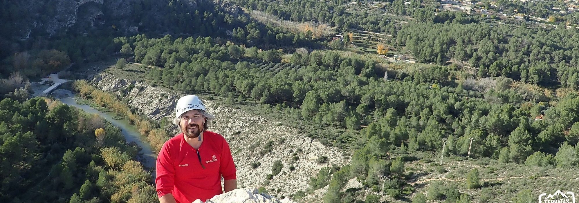
Ferrata with spectacular views of the castle of Xátiva and surroundings.
| Name | Ferrata Aventador |
| Province | Valencia |
| Nearest town | Xátiva |
| Difficulty | K3 (somewhat difficult) |
| Best season | All year around. No restrictions. |
| Escape point | No |
| State of the Ferrata | Good (2019) |
| Crashes | No |
| Bridges | No |
| Zip Lines | No |
| Rappel | No |
| Other facilities | No |
| Approach time | 15 minutes |
| Ascent time | 20 minutes |
| Return time | 20 minutes |
| Total route (approach + ferrata + return) | 2090 meters |
| Total height equipped section | 60 meters |
| Total activity level (ferrata + approach + return) | 260 meters |
| Observations | Beware of the distance between staples for short people. |
Approach by car :
We go to Xátiva and without entering the town we take the CV-6101 in the direction of Genovés, we continue until we see the indications of Alboy and urbanizations, and continue on these. The road is asphalted and narrow, we pass a bridge and immediately turn left towards the collapse: recreational area with a bar near the river that is passing the train station. We continue to leave country houses until we reach the parking area of the black cave. From the area we can see the wall of the aventador in direction SE.
.
Approach to the beginning of the ferrata :
From the parking lot there is a clear track towards the ferrata. We follow it until we run into a path that has two milestones. We ascend following the paths with several milestones always in the direction of the wall of the road until we reach the beginning of it.
Description of the Ferrata : Vertical wall of about 60 meters, The staples at the beginning are a little separated and at the end the separation is repeated.
Return :
Once on the Crest and leaving the end of the road behind us we see how the crest turns to the left and a path goes down towards the parking we continue down the path that connects with the black cave direction track.